Sky Terrain Maps Buffalo Creek, Waterton - 1st Edition
Buffalo Creek, Waterton - 1st Edition
Regular price
$8.95 USD
Regular price
$8.95 USD
Sale price
$8.95 USD
Unit price
per
Couldn't load pickup availability
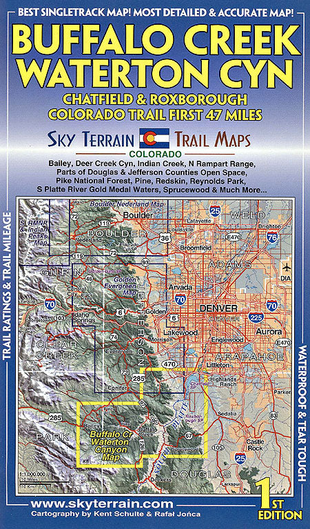
Sky Terrain Trail Maps Buffalo Creek, Waterton Canyon map covers a big chunk of the greater Denver foothills. Using eight different sets of road and trail data and GPS to produce this accurate, detailed and up-to-date map. And at $8.95 the compact, yet full map is a great value.
Includes Bailey, Deer Creek Canyon, Indian Creek, North Rampart Range, Parts of Douglas and Jefferson counties open space and the Pike National Forest, Pine, Redskin, Reynolds Park, S. Platte River Gold Medal Waters, Sprucewood and more.
Specs
- 50-foot contours
- Enlightened shaded relief reveals the rugged terrain
- All trails rated for difficulty, mileage between junctions mapped, plus mileage for some big loops shown
- Singletrack mapped
- Hiking, road biking, mountain biking, fishing, climbing, hunting, camping, white water, horseback, 4WD, and motorsports information
- Folds to 4 x 6.75 inches
SKU:9780982862612-1123476506