Sky Terrain Maps Boulder, Nederland, Flatiron, CO - 4th Edition
Boulder, Nederland, Flatiron, CO - 4th Edition
Regular price
$11.95 USD
Regular price
$11.95 USD
Sale price
$11.95 USD
Unit price
per
Couldn't load pickup availability
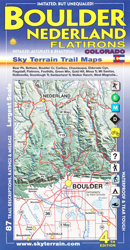
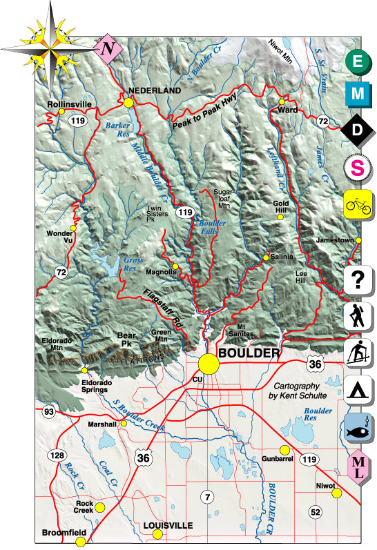
Sky Terrain Trail Maps Boulder, Nederland, Flatirons includes Boulder Mountain Parks, Eldora, Eldorado Springs, Flagstaff, the Flatirons, Foothills, Gold Hill, Gross Reservoir, Gunbarrel, Jamestown, Magnolia, Nederland, Roosevelt National Forest, Sourdough Trail, Ward and more in great detail.
Specs
- Shading and color tints enhance elevation cues and organize this complex terrain
- Trail rating symbols include difficult, moderate and easy allowing people to plan the difficulty of their outing. Key roads are also rated for road biking (paved) and mountain biking (unpaved)
- Singletrack symbol for mountain biking
- Trail descriptions include directions, trail lengths, elevation gains, noteworthy features and more
- Historic routes shown for reference
- Ideal contour intervals (50 feet) set to improve visualization of terrain forms and maximize elevation information. Extensive spot elevations
- Careful mapping and graphic stressing of the natural hydrography to improve comprehension of terrain forms
- Full UTM grid for easy use with GPS receivers. Alpha-numeric grid for location trails
- Printed on waterproof, tear-tough material for years of hands-on use
- Map scale is 1:33,000
SKU:0966550889-1123476505